2016 Visit to Crater Lake

On vacation this past week, we visited Crater Lake National Park twice. The weather was 70F on July 5th and low 50’s on July 8th. The park was typically busy for the holiday week. Rim Village was super packed. There is a lot of construction starting on the roads. East Rim Road was still closed. The trail down to the lake is going to be closed for the season on August 15th. The mosquitoes are out in force; Klamath County has several reported cases of West Nile virus, so bring the bug spray.


crater lake 2016

Crater Lake 2016


vidae falls crater1


I took these photos with my Sony A6000 and a Sony 10-18mm lens. When the sun was out I could shoot at ISO 100. I post processed these with ON1 Photo 10.

Seek Outside 8 Person Tipi

It’s almost camping season here in Oregon. After a few years absence as our youngest child got older, it’s time to start taking the kids outside again. I’m ashamed to say it’s been several years since the whole family went camping in a tent. Yeah, we go to the Cabin, and stay in yurts. That is just not the same as sleeping on the ground, in a tent, not in a campground.

It was time to upgrade the tent; to fit the whole family and the upcoming dog. I settled on an 8 person tipi from Seek Outside. I did some research; read the reviews, forum postings. Sat on the fence because of price for about a year. I was planing for a smaller tipi, but a rare sale come along to get the larger one.

image5


Failed SOTA attempt “The Twins” W7O/CM-013

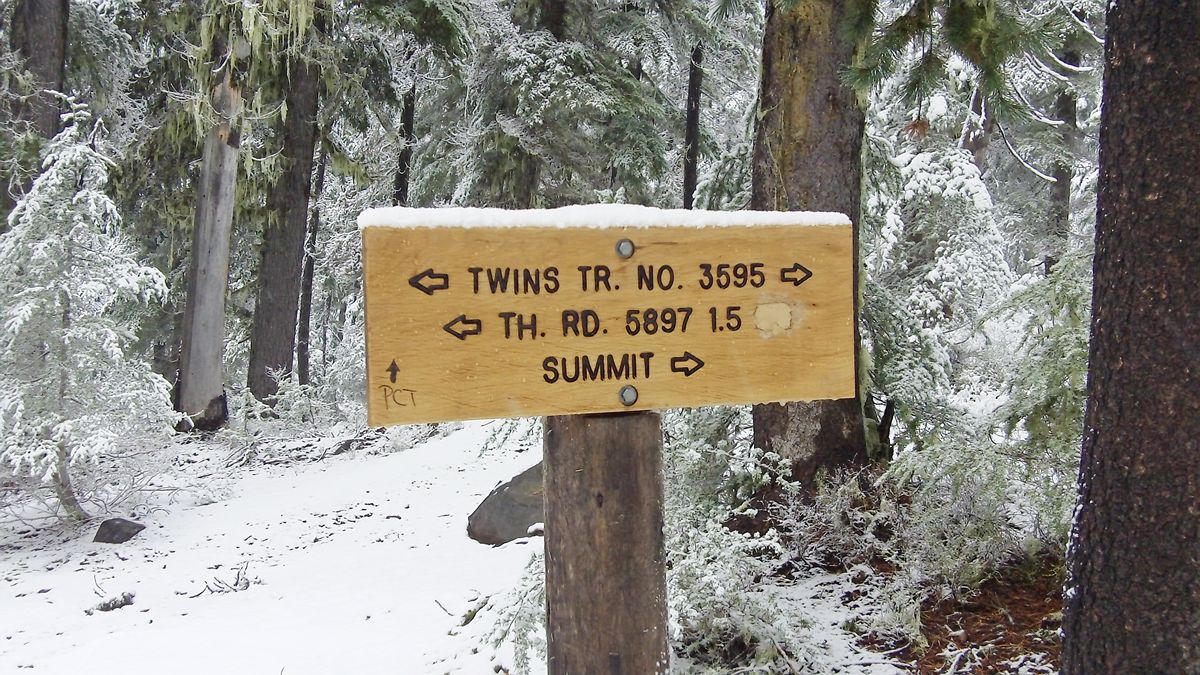
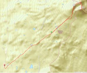
My Friend Bruce and I decided to do a late fall camping trip at Waldo Lake in the Oregon Cascades. There are a several peaks that qualify for SOTA; “The Twins” W7O/CM-o13 was closest and had a trail to the summit. This peak is 7360′ in elevation. It has a smaller, false summit that is several hundred feet shorter.

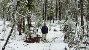
We camped in the public campgrounds around Waldo Lake and left about 10am Monday morning. It snowed lightly the night before and was pretty cold. Temperatures were no higher than 32F at that time.


the twins real summit
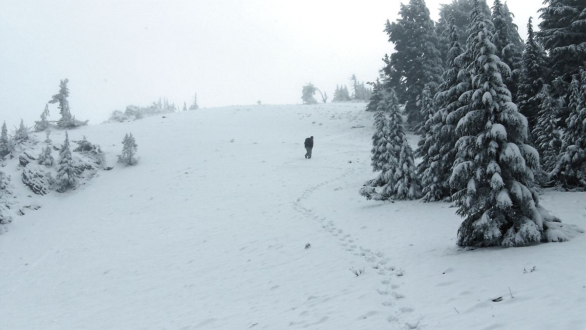
It took us until about 1pm to reach the false summit. At that point there was 2-3 inches of snow on the ground. We lost the trail at this point and debated turning around.


the twins topo

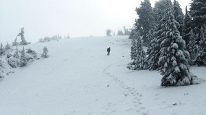
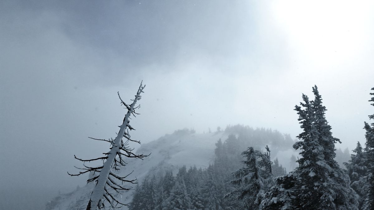
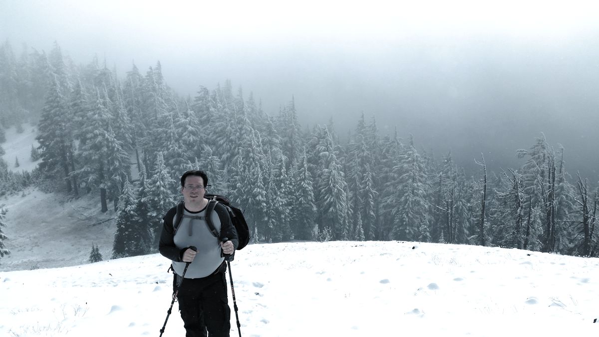
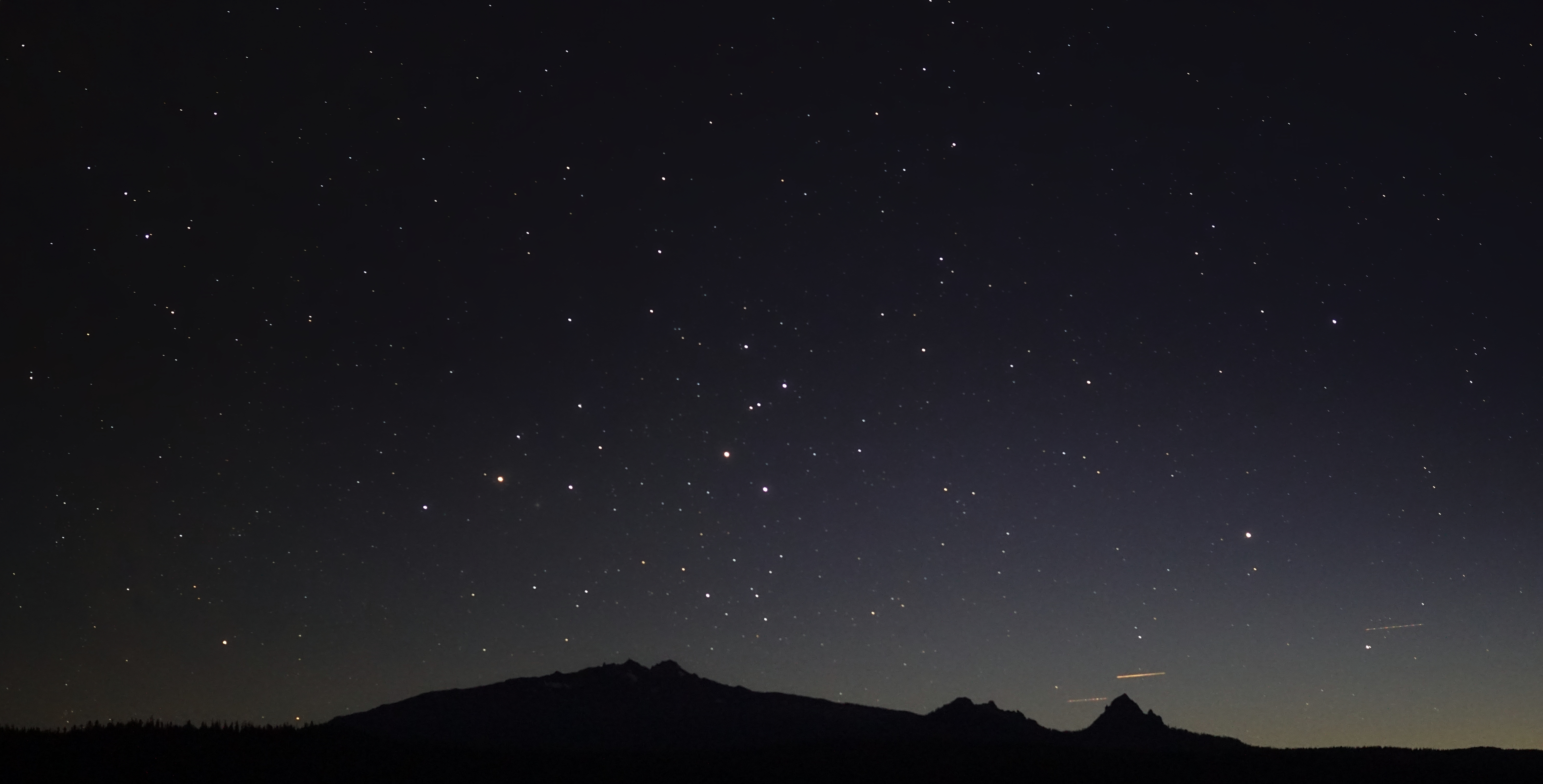
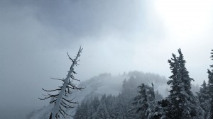
We pushed ahead and bushwhacked our way around the rim, through the exposed snowfield leading up to the summit. At this point visibility dropped to a few hundred yards. There was 4-5 inches of snow on the summit.

We found a sheltered spot on the summit that shield us from the 20+ mph winds. Bruce and I assembled the Buddipole in a 20m vertical configuration. Bruce bravely volunteered to hold it. This was my first trip in the field with my KX3. I lugged a 10ah LiFePO4 battery along. I ran the KX3 at 10 watts power output. The noise on 20m was relatively low at S2-S3. We could hear a lot of stations, but had a hard time getting the signal out. We managed three contacts on 20m before the temperature started dropping.

About 1400 the temperatures got cold enough I lost dexterity in my hands we decided to pack it up and start out descent. We spent about an hour on the summit and saw at least an inch of snow accumulation. We took our time coming down and warmed up a bit. Overall this was a seven mile hike with about 1700 feet of elevation gain.

KL7HM AZ
AL4Y AK
W0RW Pike’s Peak, CO


the twins trail sign


bruce trail


small lake


bruce final ascent the twins


Josh summit the twins


Hiking King Mountain in the Tillamook State Forest

On the tail of end of New Year’s break, my friend James and I decided to hike something in the coastal range. We decided on King Mountain as it a bit longer in length than the nearby Elk Mountain. This hike is five miles round trip with an elevation gain of about 2500 feet. Portland Hiker’s provides excellent documentation and links to maps.

We had excellent weather the Saturday we went hiking (going early in January). There was some mud in a few places and snow patches at the top. With no wind, the temperature was easily ten degrees lower at the top. The trail does not get rugged until the last half of a mile. At some points the trail is mostly loose rocks. Take walking poles and be careful of your balance.

King Mountain fog 3140resize

King Mountain steep 3163resize

King Mountain trail 3128resize

King Mountain trail 3144resize

King Mountain approach 3168resize

King Mountain summit 3176resize

King Mountain view 3180

Yet another failed winter SOTA attempt at W7O/WV-005 Coffin Mountain

This is my third attempt at activating Coffin Mountain. The second time during the winter. This year we did not even make it as far as the trip in 2012. We geared up big time for this trip. Bruce, my trip partner, and I both built pulks to carry all the extra gear needed during winter. I purchased a nice 10 amp/hour LiFEPo4 battery.

We knew by late Friday afternoon that it was not looking good. A winter storm had moved into the area. We erroneously assumed this would us help us snowshoe the route. All told, it can be up to 8.5 miles of travel from OR22. The snow was falling pretty heavily by early Friday afternoon. It was rather dry snow and we figured that the previous two days had brought about 24 inches of new snow. Our snowshoes were sinking 12 to 16 inches in the snow. This limited us to about a maximum speed of half a mile an hour. We snowshoed about two miles on Friday. Friday night brought at least 24 inches of new snow. A local resident measured it at 27 inches.

We did not make it Coffin Mountain, or it’s close sibling: Buck Mountain.

Homemade Pulk

Started building my home made pulk. Bruce picked up a couple sleds from Target. I am trying CPVC under the rim to spread the load when being pulled and add some rigidity. I picked up some fixed casters from Amazon. After the wheels removed the bolt (axel) can be put back in place. I will use these as the anchor points.